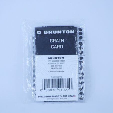
Description | Brunton Grain Size Card for geologists, made of durable, waterproof, transparent material. Features 10 grain size classifications, a PHI scale, and an integrated millimeter ruler for accurate field measurements. | Geotechnical Soil Plastic Gauge Card for fieldwork, featuring grain size scales, USCS, color charts, and rulers in cm and inches. Ideal for geologists, engineers, and soil technicians. | Brunton Transit 5020 Compass – Precision compass for strike and dip measurements, built with a rugged CNC-machined body, flat non-slip base, and high-accuracy needle system. Ideal for geologists and field professionals seeking durability, stability, and waterproof performance in challenging environments. | Brunton Omniscope is a precision inclinometer for measuring vertical angles and percent grade simultaneously through direct sighting. Built with CNC-machined aluminum and a shock-absorbing silicone cover, it features triple-scale visibility, 10x magnification, and LED lighting—ideal for forestry, geology, and topographic fieldwork. |
Brunton 5030 Geo Lite Transit is a lightweight, durable, and functional mirrored compass designed for students and field geologists. It offers essential strike and dip measurements, dual clinometers, and a built-in protractor—perfect for accurate field mapping in a compact format.
| Brunton TruArc No. 15 Compass with global needle, dual clinometers, and tool-free declination adjustment. Designed for precise navigation, slope measurement, and elevation in demanding field conditions. Includes sighting mirror, bubble level, and map magnifier. Made in the USA. |
Content | The Brunton Grain Size Card is an essential field tool for geologists, designed for the visual classification of sediment based on grain size and shape. Made from durable, waterproof, and transparent material, this lightweight card withstands all weather conditions. It features both positive and negative sides to facilitate accurate grain size comparisons and direct readings in the field.
SPECIFICATIONS:
➢ 10 grain size classifications, including the PHI scale
➢ Visual reference for grain shapes
➢ Integrated millimeter ruler for direct measurement | The Geotechnical Soil Plastic Gauge Card is an essential technical tool for fieldwork in geotechnical engineering. Made from flexible, waterproof plastic, this card offers a wide range of visual and metric references that facilitate in situ soil classification and analysis. It includes grain size scales from coarse sand to silt, a roundness chart, percent composition graphs, the Unified Soil Classification System (USCS), common soil colors, and compaction classifications for soils and sands. Additionally, it features both centimeter and inch rulers. A nylon cord is included for convenient carrying in demanding field conditions. Ideal for geologists, civil engineers, and soil technicians. | The Brunton Transit 5020 Compass combines the classic precision of traditional navigation instruments with a modern, rugged design—ideal for professionals in geology, engineering, and demanding fieldwork. It retains traditional strike and dip measurement functions while improving stability for low-angle readings thanks to its flat base and non-slip silicone foot. Its CNC-machined, hard-anodized body ensures durability, while sealed internal components provide enhanced resistance to water and dust. Comes with a high-quality leather case.
SPECIFICATIONS:
➢ Measurement type: Strike & Dip (Bearing and Inclination)
➢ Azimuth scale: 0° to 360°, with ±0.5° accuracy and 1° graduations
➢ Internal clinometer: ±0.5° with 1° graduations
➢ Percent grade scale: 5% increments
➢ Magnetic declination adjustment: ±180°
➢ Dimensions: 7.9 x 7.1 x 3.4 cm (3.1” x 2.8” x 1.3”)
➢ Weight: 195 g (6.9 oz)
FEATURES:
➢ CNC-machined and hard-anodized body for enhanced durability
➢ Flat base with non-slip silicone foot for stable low-angle readings
➢ Alignment mirror for accurate horizontal and vertical angle readings
➢ Long and short sighting arms for precise measurement taking
➢ High-precision NdFeB disk magnet with excellent demagnetization resistance
➢ Induction damping for fast needle stabilization
➢ Sapphire bearing ensures smooth and long-lasting needle movement
➢ Needle lock button for securing or releasing the needle as needed
➢ Sealed internal components with O-ring for superior dust and moisture protection
➢ Compatible with tripod or Jacob’s Staff ball adapter
➢ Comes with a protective leather field case
➢ Available in Azimuth format (0–360°) | The Brunton Omniscope is a precision inclinometer designed to facilitate the simultaneous measurement of vertical angles and percent grade through direct sighting. Its plumb-bob-style clinometer, mounted on high-precision bearings, ensures reliable readings even in demanding environments. Built from CNC-machined anodized aluminum, it offers a robust and durable structure, complemented by a silicone cover that improves grip and absorbs shocks.
Ideal for forestry, geological, and topographic use, this instrument can be used as a standalone unit or mounted on a monopod or Jacob’s Staff. Additionally, its integrated LED lighting allows for clear visibility in low-light conditions, making it an essential tool for fieldwork.
SPECIFICATIONS:
➢ Dimensions: 76.3 × 8.8 × 1.3 cm (2.5" × 3.5" × 0.5")
➢ Weight: 335.6 g (11.8 oz)
➢ Graduations: 1° scale across all three angular measurement systems
FEATURES:
➢ Direct measurement of vertical angles and slopes using a precision optical sighting system
➢ Three simultaneous scales visible in the viewfinder:
■ Left: Slope in degrees (0° to 90°)
■ Center: 66-foot forestry chain (0 to 200 ft)
■ Right: Slope in percent grade (0% to 150%)
➢ Additional side view for slope in degrees and percent grade
➢ Adjustable lens with up to 10x magnification
➢ CNC-machined anodized aluminum housing, impact-resistant and rugged
➢ Non-slip silicone cover, ergonomic and shock-absorbing
➢ Integrated thread compatible with Jacob’s Staff or Brunton monopod
➢ LED lighting system, perfect for use in low-visibility conditions
➢ Includes a protective leather case for safe field transport
➢ Made in the USA, in Riverton, Wyoming | The Brunton 5030 Geo Lite Transit is a mirrored, flat-base compass specifically designed for students and field geologists who need a lightweight, precise, and functional tool without sacrificing the essential capabilities of a traditional transit. Inspired by the design of the Geo Transit model, the Geo Lite delivers reliable performance in a more compact format. It features two clinometers (plumb-style and hinge-style), allowing for effective dip and dip azimuth measurements. It also includes an integrated protractor for direct plotting of data on topographic maps during fieldwork. Its transparent base is hot-stamped for enhanced durability, and the flat structure allows for accurate measurements even at low angles. Additionally, the lid is made from recycled glass-filled PA (polyamide), providing greater resistance to long-term use.
SPECIFICATIONS:
➢ Dimensions: 10.16 × 6.3 × 1.5 cm (4” × 2.5” × 0.6”) ➢ Weight: 68 g (3.2 oz) ➢ Azimuth: ±1° with 2° graduations ➢ Hinge clinometer: ±2.5° with 5° graduations ➢ Internal clinometer (plumb-style): ±2.5° with 5° graduations ➢ Magnetic declination adjustment: ±180° (tool-free)
FEATURES:
➢ Direct-read azimuth system in transit style ➢ Slim needle for more accurate readings ➢ Fixed plumb-style clinometer, unaffected by declination adjustment ➢ Hinge clinometer for simultaneous dip/dip azimuth measurements ➢ Integrated protractor for mapping and plotting in the field ➢ Bubble level for improved strike measurement accuracy ➢ 2° resolution for azimuth readings, 5° resolution for clinometer readings ➢ Durable EverNorth magnet, resistant to long-term demagnetization ➢ Integrated map magnifier on the base ➢ Sighting mirror for precise directional readings ➢ Romer scales included for GPS compatibility ➢ Flat base for accurate measurements at low angles ➢ Hot-stamped baseplate for enhanced wear resistance ➢ Lid made of recycled, glass-filled polyamide for extended durability ➢ Made in the USA, in Riverton, Wyoming ➢ Perfect as a primary compass or a reliable backup for extended fieldwork
| The Brunton TruArc No. 15 Compass is a professional-grade navigation tool built for the most demanding field conditions. Designed for mountaineers, rescue teams, scientists, and explorers, it features a mirrored baseplate and dual clinometers (internal and lid-mounted) for accurately measuring slope angles and elevations. Its global needle provides stable readings anywhere in the world, while its durable, high-visibility design ensures accurate orientation in even the toughest environments.
SPECIFICATIONS:
➢ TruArc™ Global Needle: Tilts up to 20° for reliable performance worldwide.
➢ Tool-free declination adjustment: Quickly aligns magnetic north with true north.
➢ Meridian lines on vial: Assist in aligning with map grids during trip planning.
➢ Inch and millimeter scales: Enable precise measurements in any mapping system.
➢ EverNorth™ Magnet: Resists demagnetization over time for long-term reliability.
➢ Magnified readout: Offers high precision without sacrificing readability.
➢ Dual azimuth ring: Includes reverse azimuth capability.
➢ Integrated sighting mirror and line: Ensures accurate bearings when taking or following a direction.
➢ Dual clinometers (in lid and vial): 2° resolution for measuring slope or object heights.
➢ Engineer’s ruler: Useful for technical field measurements.
➢ Bubble level: Ensures compass is level for accurate readings.
➢ Map magnifier: Helps identify small details in map work.
➢ Removable high-visibility cling: Enhances performance in low-light environments.
➢ 1° resolution azimuth ring: For precise directional readings.
➢ Dimensions: 4” x 2.5” x 0.6” | 10.16 x 6.3 x 1.5 cm
➢ Weight: 3.2 oz | 91 g
➢ Made: In the USA Riverton, Wyoming. |
Reviews
There are no reviews yet.